We recently published an article in The Conversation on Peat Management and Issues in Indonesia. Sorry in Bahasa Indonesia.
But here is an English version of it:
Can Indonesian peatland be managed responsibly?
Supiandi Sabiham1,2, Budiman Minasny3, Budi Indra Setiawan1, Dian Fiantis4
1 Institut Pertanian Bogor, Bogor, Indonesia. 2 Perkumpulan Masyarakat Gambut Indonesia. 3 The University of Sydney, Sydney, Australia. 4 Universitas Andalas, Padang, Indonesia.
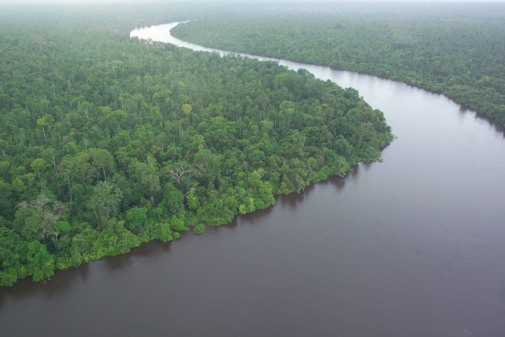
Peat holds one of the largest carbon stock in the terrestrial ecosystem. Especially in Indonesia, it has one of the largest areas of tropical peatland, with the current estimate around 13.2 million hectares. Prior to 1990s, peatland is considered as a marginal land, encouraged by the government to be exploited. In 1995, the late president Soeharto directed the Mega Rice Project, developed 1 million hectares peatland in Central Kalimantan for rice cultivation. The project turned out to be a disaster, the peatlands were heavily drained, rice cannot be grown successfully, and peats were degraded, fuelled fires during extended dry seasons.
With the increasing awareness of climate change, greenhouse gas emission from agricultural land use and farming practices, and forest and peat fires, peat use for agriculture in Indonesia becomes a highly controversial topic.
As a response to the huge forest fire in Indonesia in 2015 particularly in peatlands, the Indonesian government attempts to restore degraded peatlands by issuing a governmental regulation no. 57 year 2016, which is an emendation of the previous regulation no. 71 year 2014 on the conservation and management of peat ecosystem. One of the chapters in the no. 57 regulation stated that managed peat ecosystem is considered to be degraded if its water table is greater than 40 cm when measured from the surface of the peatland at a managed location. This ground water table regulation was meant to keep the peat moist so that it is not susceptible to fire during the dry season. It also means that water table in managed peatlands need to be maintained at 40 cm all year round.
This 40 cm criteria was arbitrarily chosen and was set as a regulation without the involvement and consultation with academics and not supported by a strong scientific evidence. Implementation of the regulation should also take into account the socio-economic balance between the communities and the environment around peatlands.
As a response to this government regulation and its derivatives, academics and peatland practitioners conducted a workshop in Bogor on the 14th of December 2017 to discuss the possibility of peatland management which minimises the environmental impact. Science can help guide sustainable peat management.
While there have been much research on peatlands in Indonesia, most overseas research focussed on deforestation, carbon losses due to plantation, and peat fires. We need research on peatland management that addresses the new regulations.
Peatland has two main functions namely environmental services (water storage, carbon, and biodiversity protection) and producers of agricultural commodities that support the livelihoods of farmers. It is necessary to maintain a balance between conservation and agricultural functions. Balanced research needs to be focused on good and rational peat management efforts, minimizing environmental impacts, and water management that reduces the risk of fire.
We identified several knowledge gaps on peat management in Indonesia, which can be summarised as follows:
- Peat mapping
Nationally, peat areas have been mapped at a coarse scale of 1:250,000 indicating a peatland area of about 14 million hectares in Indonesia. This coarse-scale map cannot be used for management. For it to be useful operationally, the map has to be at a scale of 1:50,000 or finer. In modern mapping terms, the resolution of the raster needs to be at least 30 m. This fine scale map needs to be generated using an accurate, cost-effective, and rapid method. In Indonesia, many were convinced that Lidar, a laser equipment that is flown commercially, is the method for mapping peat extent and thickness. Flying Lidar across the whole country is an expensive exercise, furthermore Lidar only measures the surface elevation of the ground, and cannot detect directly the extent and thickness of peats. Lidar was heavily promoted for mapping peat without a solid scientific evidence. Research from The University of Sydney and IPB has developed an open digital mapping methodology that combines field measurements and remote sensing images. Peat extent and thickeness can be mapped using machine learning algorithms. This methodology is cost-effective as it uses open data in an open source computing environment. This evidence-based method has been successfully evaluated and potentially can be upscaled to map peat for the whole of Indonesia.
- Agricultural commodities and land degradation
Much research has been conducted on management of strategic crops, especially food crops and plantations on peatlands. Responding to this regulation which limits the development of oil palm, we need a multi-disciplinary approach to seek for alternative crops that can benefit smallholder farmers. For example, paludiculture (cultivation in marshland) has been suggested as a feasible option, however market access needs to be fully considered.
The true impact of land use change has to be examined completely. The current land use change has been blamed for causing deforestation and peat degradation. Land use change which lowered of groundwater level caused peat subsidence which was interpreted as peat loss and increased CO2 emission and triggered fire outbreaks. Peat degradation is a long-term process which is not triggered by the current land use. Land degradation has started at least since the 1900s during the Dutch colonial period with its transmigration program, and followed in 1970s with the licensing of forest concession.
- Greenhouse gases emission and groundwater level
CO2 emission from peatland as caused by land use change has to be fully examined. We cannot deny that land use change from natural forest to plantation cause an increase C emission from oxidation of peat. However the actual CO2 emission rate needs to be thoroughly investigated. In particular:
- Peat subsidence is commonly interpreted as the loss of peat, and turn into CO2 in the atmosphere. Subsidence is a process of land consolidation which depends on the pore space and water content of peat. In addition, subsidence rate is not linear with time, in other words a large rate can be observed at the beginning of land conversion, and the rate will decrease with time.
- Net CO2 emission is a function of organic matter sequestration and decomposition. Most research only measures CO2 emission during a particular time of the day once a month. The rate of CO2 emission fluctuates over the day and throughout the year. In order to account for all these variations, we need a fully integrated system that can monitor these fluxes over a long period of time.
The ground water level set by Regulation No. 57/2016 is not based on a strong scientific evidence. Groundwater level fluctuates seasonally with rainfall and drainage. It doesn’t necessary reflect the peat’s moisture condition. In addition, the impact of a relatively high water table needs to be further established. Water content of the surface peat maybe more indicative on the moisture status of peat. There is a critical water content where peat becomes hydropohobic (difficult to rewet), such critical content needs to be well researched and established. In addition, a fire drought index which considers rainfall, water table and soil hydrological condition is more useful as a forest fire risk monitoring.
A Bottom-Up Approach
The current peat restoration process uses a top-down approach by establishing a government regulation. However, for a process to be fully adopted and well received by land holder and academics, we need a bottom-up approach which was supported by well-grounded research in managing peatlands, such as:
- Water management via a drainage system which optimises the water supply to maintain peat’s moisture condition, plant growth, particular in the dry season.
- Maintaining a groundwater level not greater than 80 cm, when measured from the peat surface. Peat has to be maintained at a moist condition so it maintains its hydrophilic nature. Monitoring drought and susceptibility of fire using hydrological models can help predict the occurrence of fire.
- Managing peatland that can support plant growth without causing land degradation based on Best Management Practice which will prevent the occurrence of fire during dry season.
An integrated research needs to be formalised as a collaboration effort. A comprehensive research program is through the application of adaptive technology, livelihood development, as a collaboration between academics, farmers, business people, and government officials which ensures that the outcomes can be recommended as a peat management program which can be sustainable.
Leave a Reply