Toba highland peatland is unique in the tropics, it is extensive, with an age of 20,000 – 30,000 years. It is the largest carbon store on land, holds records of our past vegetation, climate and human activities. This peatland is currently being used for agriculture, mined and left degraded. The drained peat causes high C emission to the atmosphere, water lost, air pollution and risk to fires. A conservation effort to restore these peatlands is urgently needed.
There has been lots of interest focussed on lowland peats in Indonesia with studies in Riau, South Sumatra, and Central Kalimantan. Indonesia also has tropical highland peats which can be found in North Sumatra, Sulawesi, and Papua. These have not been well described and documented.
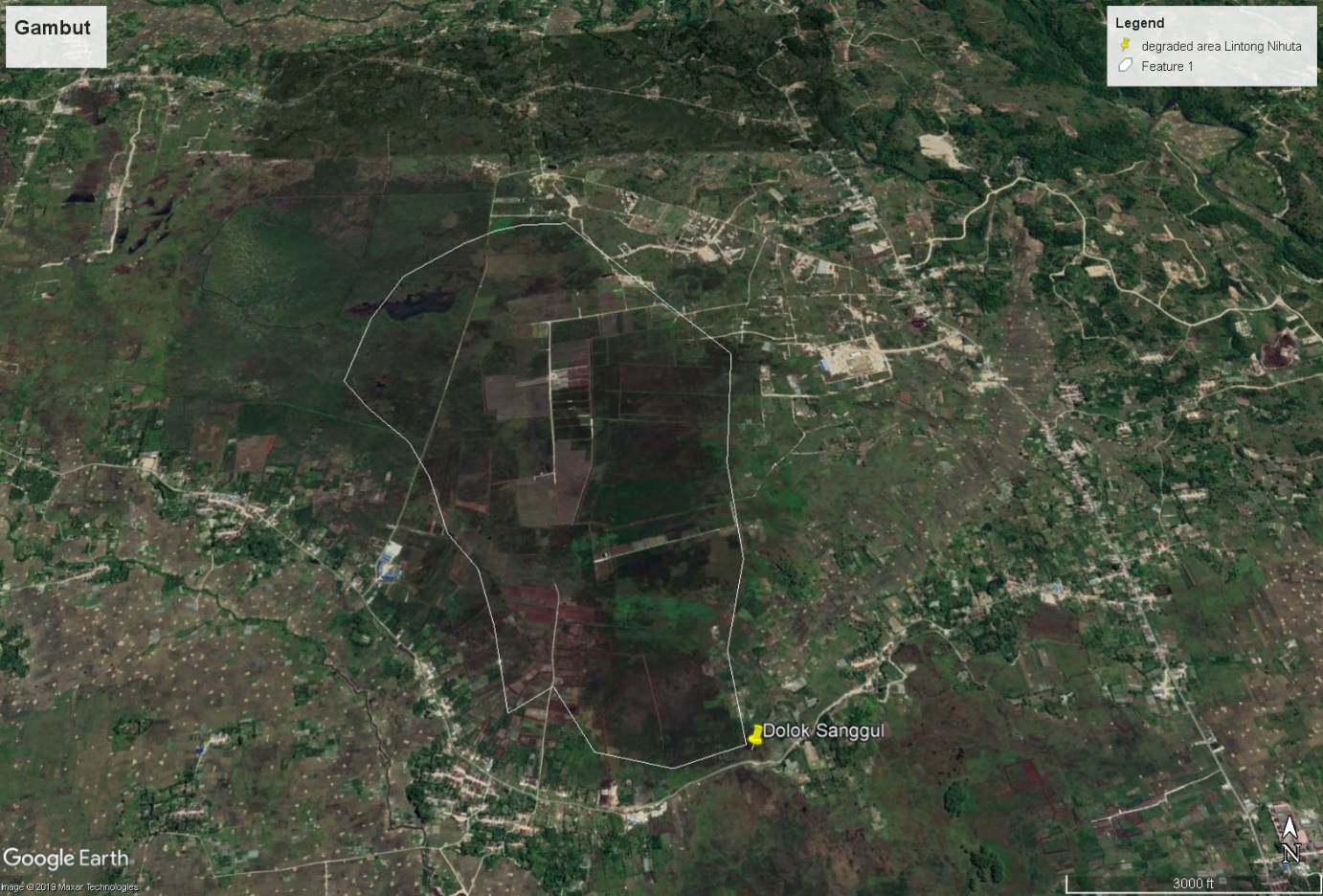
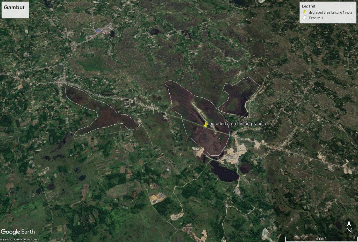
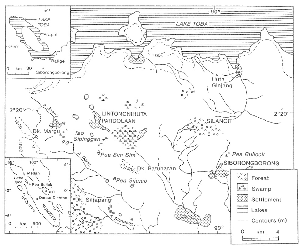
The Toba highland peat occurred in the Humbang Hasundutan regency, Southern side of Lake Toba. There’s a couple of large peatlands: Dolok Sanggul and Pollung in the west, and Lintongnihuta in the east. Each of the peatland is about 2,000 ha. The exact area is unknown. It was described in the Indonesian 1:250,000 geology map as alluvials. Only a few Indonesian studies have looked at this peatland.
The peatland is long-known to exist, and its natural vegetation has been cleared. Currently, several areas are used for agriculture (horticulture, coffee, and rice). Most are already cleared, some are abandoned, some filled with sedges and grasses.
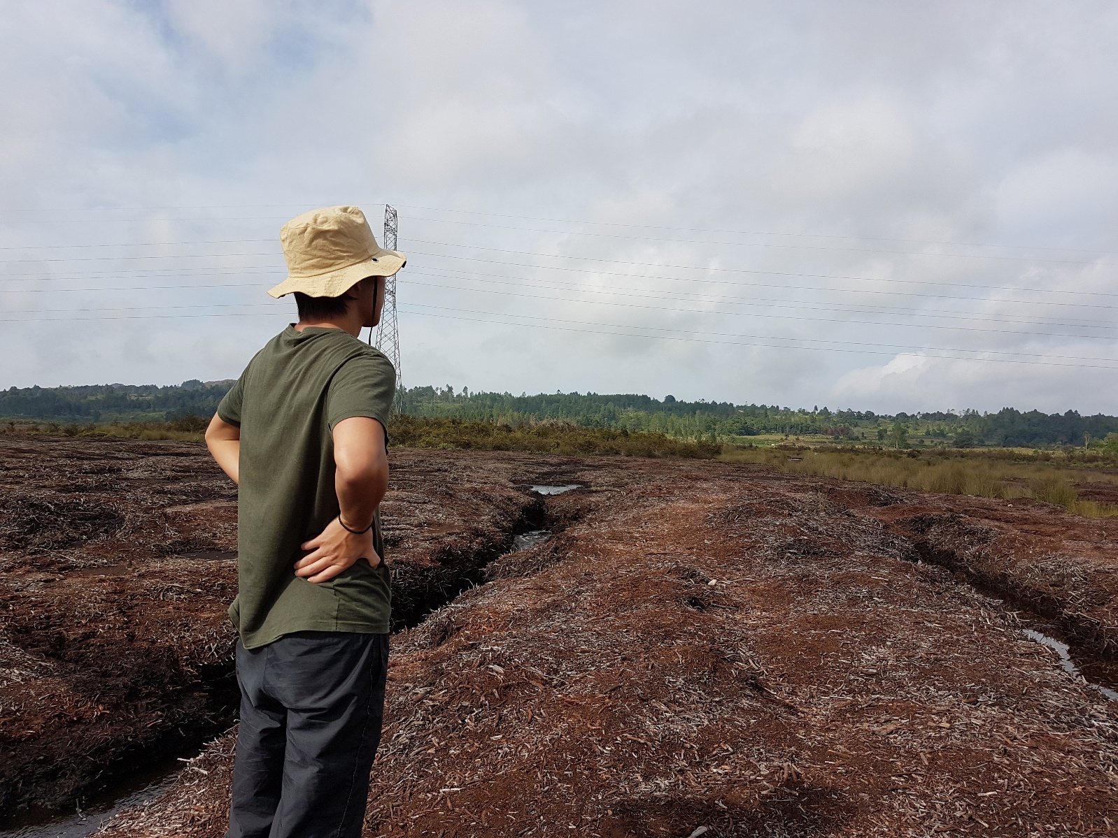
Site in Dolok Sanggul
Site at Dolok Sanggul
Unlike northern highland peats made from mosses, the Toba highland peats are from woody materials with thickness 1-10 m.
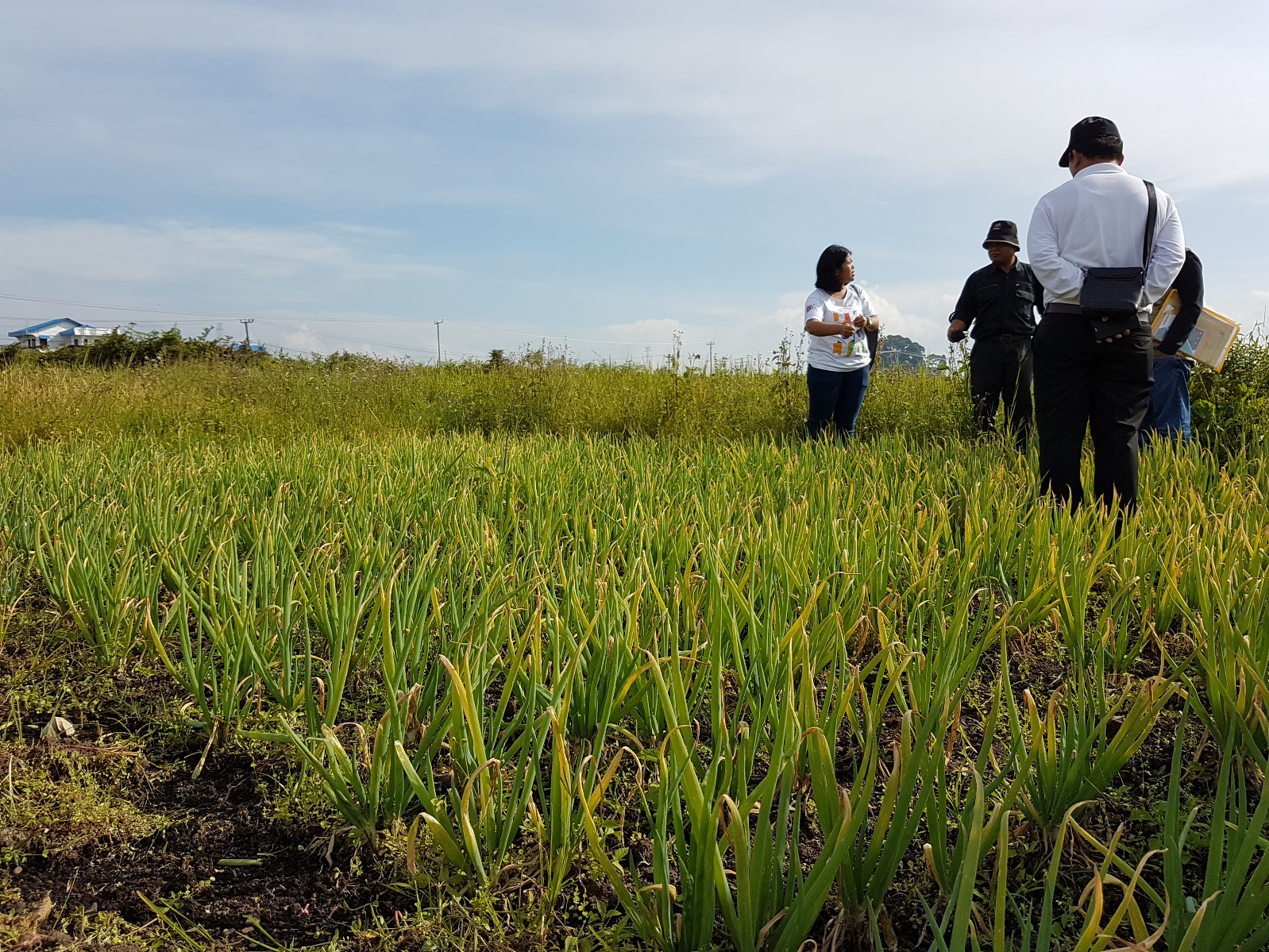
Peat being used for growing onion
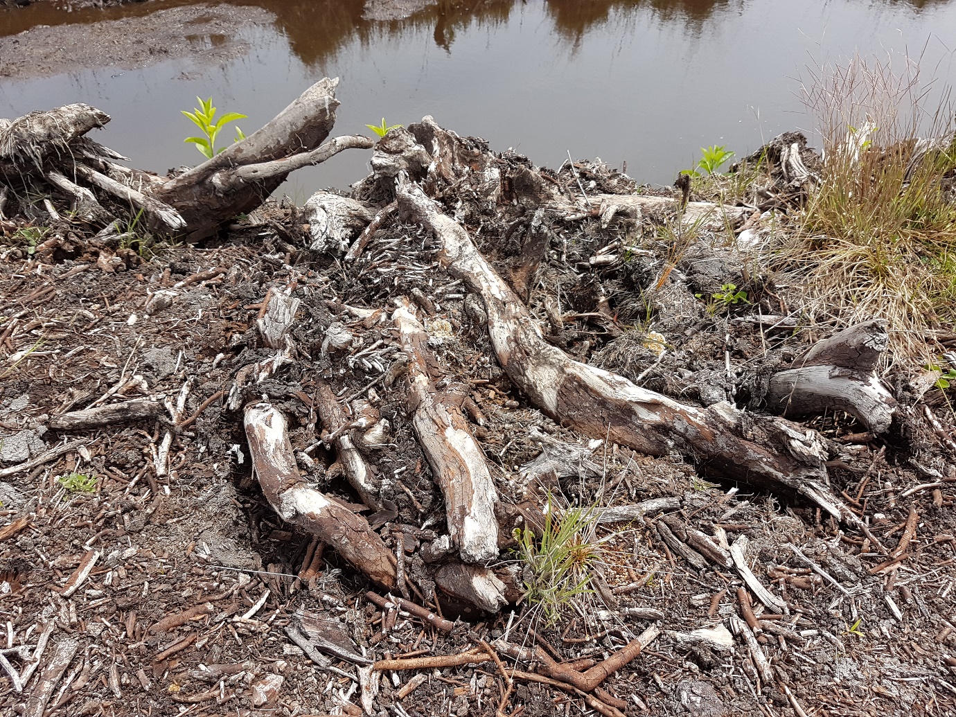
The areas are mostly depression with previous plant materials being deposited and under saturation. The materials that made up these peats are from trees. Undecomposed large woods can be seen. Thickness range from 1-3 m. Some of the areas that have been exploited are much thinner now (less than 1 m).
A large area in Lintong Nihuta was previously mined as fuel. In 2013, the local government issued a local regulation to protect these peats from being mined. Particularly, the local regulation said that peats deeper than 1 m cannot be used.
Site at Lintong Nihuta
Degraded peat at Lintong Nihuta
Peat thickness and C stock
Peat thickness in the area varies. Maloney’s research in 1970s show some area with thickness up to 10 m.
A Master thesis by Rio Tarigan from IPB indicated an average thickness of 2.5 m, surface bulk density of 0.28 g/cm3 and C content of 56%. (No exact location given)
A Bachelor thesis by Grandis Sitanggang from USU showed peat thickness around 0.6-1 m, with an estimated area arund 6900 ha in 3 areas: Dolok Sanggul (2800 ha), Pollung (1600 ha) & Lintong Nihuta (1800 ha) based on existing geology map. The extent of the area is mostly larger.
Environmental Degradation
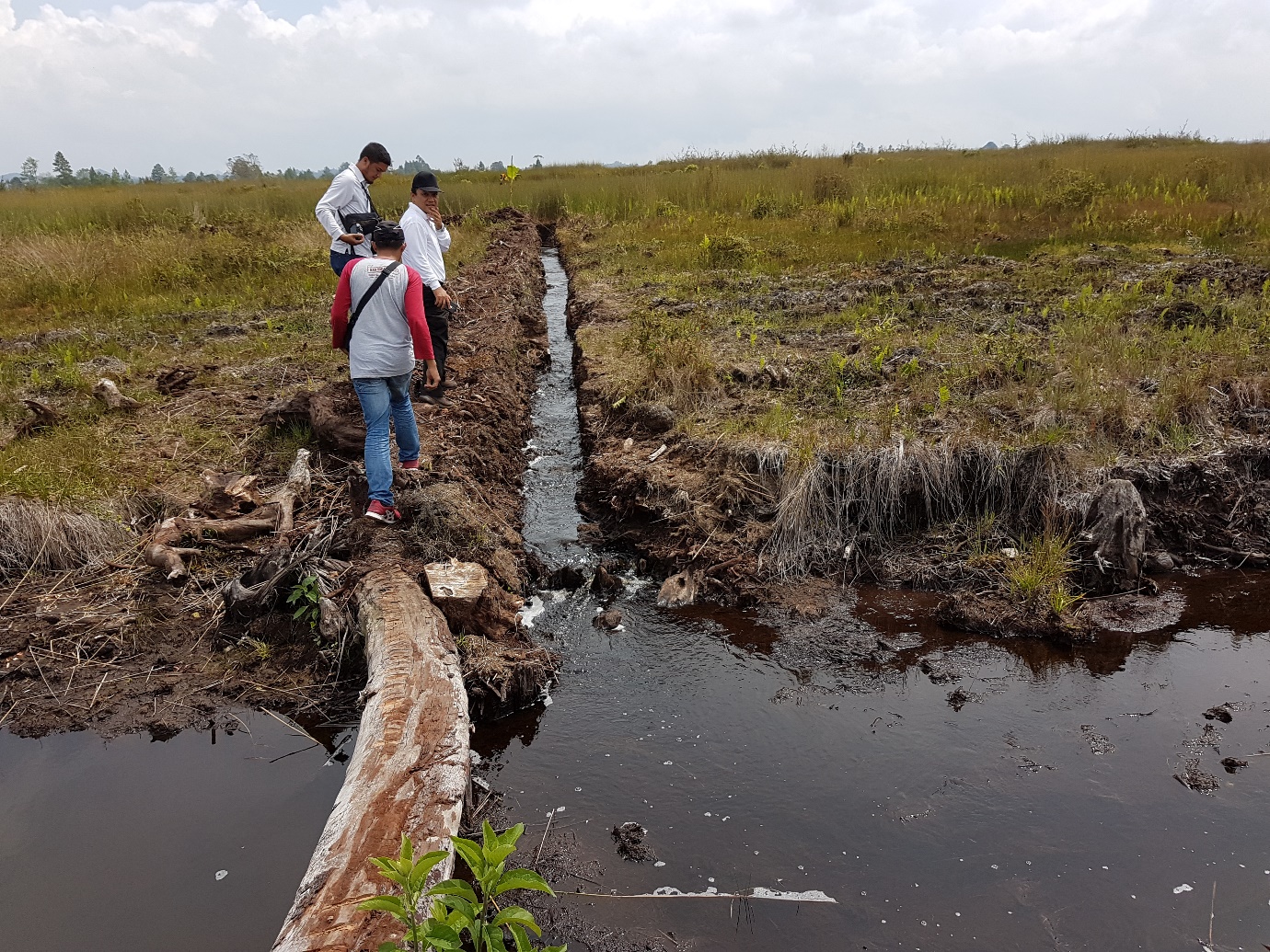
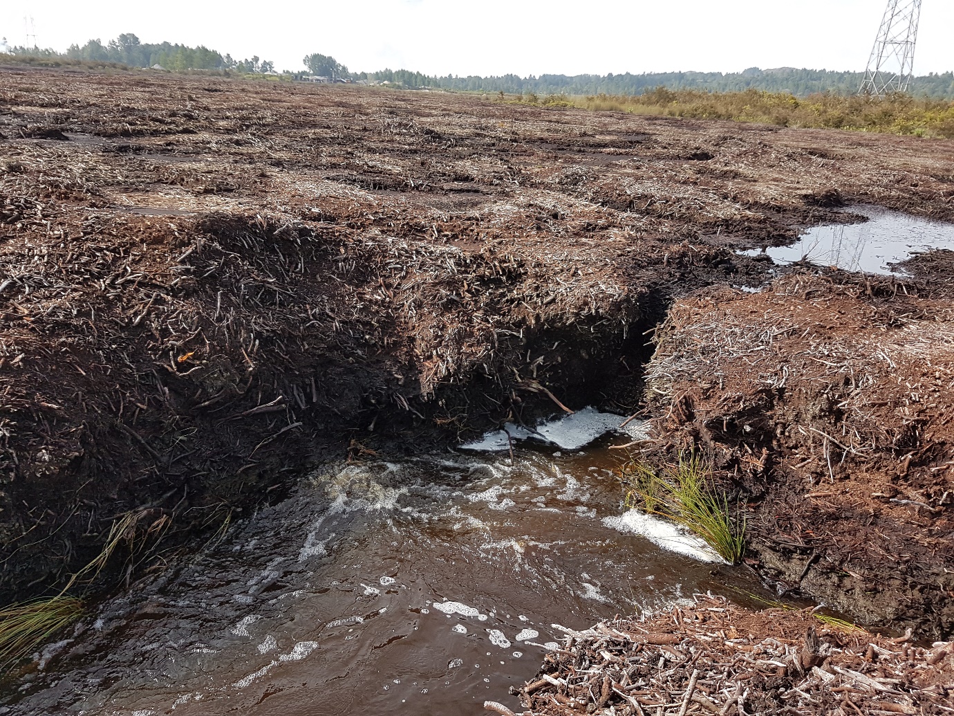
Desa Nagasaribu in Lintong Nihuta area was mined as fuels by locals to supply fuels for a local pulp and paper mill (Indorayon or Toba Pulp Lestari) in 1996. The area was drained (water is still flowing out from the drain). While mining has now stopped due to local government regulation, since 2013, the area has not been rehabilitated. Locals still collecting woods and used as charcoals in an open fire burning. A study from USU indicated that this local use of peats as fuels using open burning area has created a large amount of pollution.
Problems created from this drainage:
- Exposing peats to be oxidised, and subsidence, large CO2 emissions
http://agris.fao.org/agris-search/search.do?recordID=MY2014001239
- Water to local traditional paddy fields been reduced, some farmers experienced their fields being dried out
http://www.silaban.net/2006/10/11/pengambilan-tanah-gambut-di-lintongnihuta/
- The loss of biodiversity
- Locals used open fire burning to make charcoal from woods collected from peats, which create air pollution
http://www.gobatak.com/kayu-arang-ladang-gambut-harta-terpendam-di-nagasaribu/
- Fire hazard
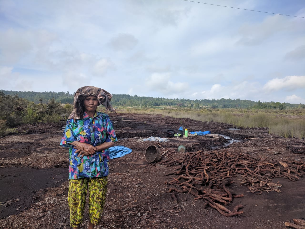
Locals are mining woods from peat and sell as fuels. It destroys carbon stored for thousands and years and being used as cheap fuels.
The age of peat
Bernard Maloney from the Paleoecolocy centre in Queen’s University in Ireland had conducted several studies during the 1970s for his PhD thesis at Hill University. Maloney’s research is into climate and vegetation change in the past 100,000 years.
He has several sites in the Toba highland peats.
Pea Bullock
The site he referred to “Pea Bullock” is north of Siborong Borong, about 1400 m above sea level. We can’t find the site now and people in the area don’t know this “pea bullock” location. “Pea” in Batak language means swamp or pond, and probably it is “bulok”. The closest location that it could be Huta Gambut (2o 13’ 45”, 98o 58’ 35”) at an elevation of 1322 mm, about 2 km north of Siborong Borong. This is the site dated oldest 28,840 ± 460 years BP at 7.25 m depth. Maloney thinks it is an extinct volcanic crater.
The location of sites from Maloney’s work.
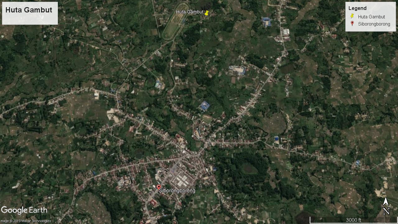
The probable location of pea bulok is Huta Gambut.
In the paper, Maloney described:
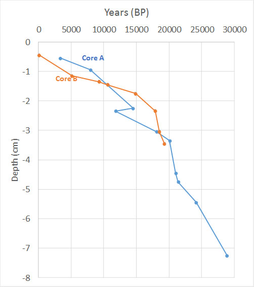
“The stratigraphy of Pea Bullok contains much wood and this, with the extreme wetness of the bog surface, makes coring very difficult. Several attempts were made during late 1973-early 1974 to obtain long cores using a Russian peat borer, with a Dachnowsky piston sampler for the stiffer material. Most were frustrated. However, the final try in February 1974, which was really aimed only at collecting data for stratigraphic description, resulted in considerable success: an 8 m long core was extracted from the edge of the site.
However, only a few samples from the last metre were kept as it was assumed that it would be possible to core again taking samples rather than just describing the stratigraphy. In fact it was not possible to get beyond 6 m during the second coring. So there is an unfortunate gap in the core (Core A) from the edge. The infill base was not reached either in the 8 m core or the shorter core from the centre of the site.”
The radiocarbon dating shows that, at the bottom of the peat (8 m), the age is close to 30,000 years BP.
Other sites are summarised in Maloney’s 1996 paper. Maloney, B.K., 1996. Possible early dry-land and wet-land rice cultivation in highland North Sumatra. Asian perspectives, pp.165-192.
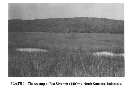
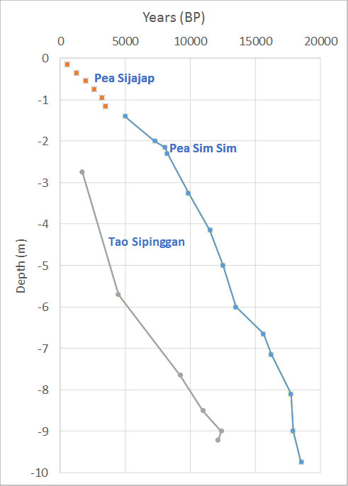
Pea Sim Sim is from Maloney’s work published in Nature in 1980, at elevation 1450m, which is close to Lintong Nihuta, with age of 18,497 ± 95 years BP at the basal depth of 9.75 m. Pollen analysis from the study suggests that human has cleared the forest in the area ~7500 years ago.
(Figure from Maloney, 1998, Human Activities and the Tropical Rainforest: Past, Present and Possible Future)
Tao Sipinggan, described in a 1985 paper, the site was at elevation 1445 m, was dated at 12,116 ± 140 years BP at the depth of 12 m. It is also close to Lintong Nihuta.
“Tao Sipinggan is another extinct crater located on the plateau and has steep sides, but some level (or leveled) land surrounds the lake. The core analyzed was extracted through a floating mat at the south end of the site and consisted largely of organic material as a swamp forest seemed to have been present at the lake margin in the past, but fields were later constructed when this was removed. The upper part of the sublake surface stratigraphy contains Toba tuff.”
Pea Sijajap is at about 100 m lower altitude in the Simamora rift. “Pea Sijajap is a small, almost totally infilled volcanic crater, but it is at about 1300 m altitude in a downfaulted rift valley, not on the plateau. At the time of coring, a very small area of unreclaimed herbaceous swamp existed at the center of the site, surrounded by wet-rice fields and low scrub vegetation on dry land beyond that. Four radiocarbon dates have been obtained from the upper 1.15 m of the short core, but the uppermost one is inverted.”
The age of the peat is between 20,000-30,000 years. This is 3 times older than lowland coastal peatland in Riau, which was dated to be 6500 years BP.
The average peat accumulation rate at a very slow rate between 0.1-0.6 mm/year.
Pea Bullock: 0.12 mm/year (0.1 Mg C/ha/yr) during the past 17,000 years and 0.40 mm/year (0.2 Mg C/ha/yr) from 17-30k years
Tao Sipinggan: 0.44 mm/year (0.2 Mg C/ha/yr)
Pea Sim Sim & Pea Sijajap: 0.27 mm/year (0.1 Mg C/ha/yr) for the past 10,000 years and 0.69 mm/year (0.4 Mg C/ha/yr) for the past 10-20k year
In summary, these peats are high value carbon stock and stores record of our past 30,000 years. It is the oldest peat in Indonesia, 3 times older than lowland peats in South Sumatra.
Work is underway with researchers from USU and UGM to map out the area and places conservation effort to these peats.
References:
Fujimoto, K., Miura, M., Kobayashi, S. and Simbolon, H., 2019. Habitat evolution of a peat swamp forest and belowground carbon sequestration during the Holocene along the coastal lowland in Central Sumatra, Indonesia. Progress in Earth and Planetary Science, 6(1), p.41.
Maloney, B.K. and McCormac, F.G., 1996. Palaeoenvironments of North Sumatra: a 30,000 year old pollen record from Pea Bullok. Bulletin of the Indo-Pacific Prehistory Association, 14, pp.73-82.
Maloney, Bernard K. “Pollen analytical evidence for early forest clearance in North Sumatra.” Nature 287, no. 5780 (1980): 324.
Maloney, B.K., 1985. Man’s impact on the rainforests of West Malesia: the palynological record. Journal of Biogeography, pp.537-558.
Leave a Reply