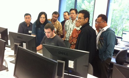
The Soil Security Lab in the Faculty of Agriculture and Environment at the University of Sydney was requested to provide a training program for nine delegates from the Indonesian Agency for Agricultural Research & Development (IAARD), Ministry of Agriculture on Digital Soil Mapping. The program was designed by A/Prof. Budiman Minasny as a response to the demand from the Indonesian counterpart on the need for new techniques that can be used to accelerate soil mapping in Indonesia.
The workshop was conducted 7 – 15 March 2013. The nine delegates were mainly responsible for producing and delivering soil information and spent their time learning about the latest development in digital soil mapping developed here at the University of Sydney.
Indonesia, as part of the Oceania Node, is taking part in the GlobalSoilMap project. This training gave a good understanding on the concept of digital soil mapping. A/Prof. Budiman Minasny has worked previously with ICALRD. He has delivered a seminar to the staff at ICALRD in 2010 introducing digital soil mapping and the GlobalSoilMap project. He provided a visiting scholarship through the Crawford fund, for Mr. Yiyi Sulaeman (staff at ICALRD) to study in Sydney in 2011. Also provided a scholarship to attend the Digital Soil Mapping conference in Sydney in April 2012.
The program (see attachment) includes lectures and computer practicals delivered by staff of the University of Sydney: A/Prof. Budiman Minasny, Prof. Alex. McBratney, Dr. Brendan Malone, Dr. Nathan Odgers, Sebastian Campbell and Jose Padarian. There’s also a guest lecture by Prof. Sabine Grunwald from The University of Florida.
All participants follow the course enthusiastically. The following are some of the feedbacks:
- There is still a misconception about digital soil mapping in the beginning of the course. Most still think digital soil mapping is about digitizing soil maps. But at the end of the course, the participants understand that it involves making maps using modern digital techniques.
- The participants are able to use open-source software such as R and SAGA to analyse their own data.
- The concept of raster is still new, and a challenge to apply it in Indonesia, and many government agencies still work in Raster format.
- Land evaluation appears to be an important part of mapping. This should not be a limitation of digital soil mapping. In fact making the process easier. First is to generate digital maps of soil properties, and the land evaluation rules can be applied into the soil layers, making the work more efficient.
- With more practicals and applications, the participants will be able to use the techniques and make the digital soil mapping process a routine of their work.
- Evaluation from the participants showed that most participants are very satisfied with the course.
- The map disaggregation method is the most interesting topic and relevant to Indonesian soil mapping.
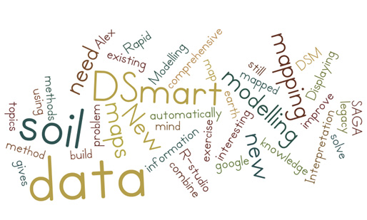
What did you find most interesting about this workshop?


Leave a Reply